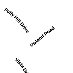
12 OVERLOOK DRIVE
Owner Information
PRODANAS JUDITH A
12 OVERLOOK DRIVE
DANVERS, MA 01923


Property Details
12 OVERLOOK DRIVE is classified as a Single Family Residential (Colonial).
The primary structure on this property was built in 1990. There are 2,409ft2 of built area within this property. There is 2,409ft2 of residential/living space within this property. This property is listed as having 7 rooms.
12 OVERLOOK DRIVE is valued at $550,500. The land is valued at $271,300 and the structures are valued at $279,200.
This property is in Zone R2. Confirm with local Zoning Board authorities to ensure there are no overlays or other easements on this property.
12 OVERLOOK DRIVE was last sold on Friday, June 7, 1991 for $0.
Assessment data from fiscal year 2022.
Flood Data
According to the FEMA National Flood Hazard Layer, this property does not appear to be in a flood zone. It may also be in an area not yet reviewed. Nonetheless, confirm this information prior to taking any action.
To view the flood hazards around this property, create a FEMA "Firmette" Map of the area around 12 OVERLOOK DRIVE.
Broadband Internet Providers
| Provider | Type | Bandwidth (mbps) | |
|---|---|---|---|
| Crown Castle Fiber | Fiber | 0 | 0 |
| VSAT Systems, LLC. | Satellite | 2 | 1 |
| HughesNet | Satellite | 25 | 3 |
| GCI Communication Corp. | Satellite | 0 | 0 |
| T-Mobile | Fixed Wireless | 25 | 3 |
| Comcast | Cable | 1000 | 35 |
| Verizon New England Inc. | Fiber | 940 | 880 |
| Verizon New England Inc. | DSL | 5 | 0 |
| Viasat Inc | Satellite | 100 | 3 |
Broadband service provider data from December 2020.
Adjacent Properties
- 14 OVERLOOK DRIVE
Single Family Residential owned by SABINA JOHN A - 10 OVERLOOK DRIVE
Single Family Residential owned by BECK JEFFREY A - 15 VISTA DR
Single Family Residential owned by STEWART MARIANNE T. - 19 VISTA DR
Single Family Residential owned by MCEACHERN CLAUDIA TRUSTEE - 17 VISTA DR
Single Family Residential owned by LIGHTIZER JOHN W